Breckenridge
Trail and Mountain Maps
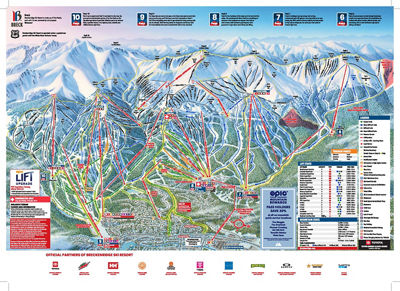
Five Peaks. One Incredible Mountain
In winter, Breck’s Five Peaks are home to 187 trails for skiing and riding, plus a whole bunch of take-your-breath-away, above-treeline terrain that offers views for days.
In summer, Peak 8 is the hub of the resort’s Epic Discovery adventure activities featuring scenic chairlift rides, climbing walls, ropes courses, and the classics - the Alpine Slide and Gold Runner Coaster.
Paper trail maps will be available in-resort upon request.


Download My Epic App
Live Webcams and Weather
Lift Line Status and Forecasts
Interactive Trail Maps
Your Phone is Your Pass
Real Time Operational Alerts
View Your Personal Stats